Taylor Canyon Loop
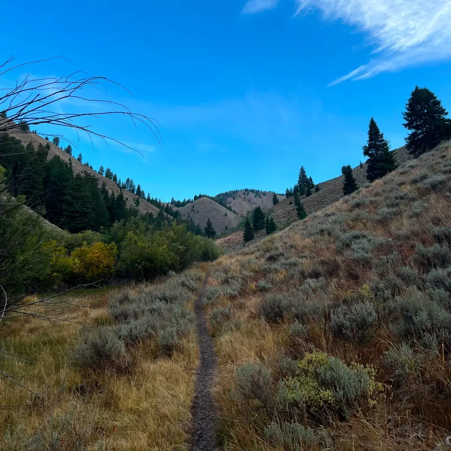
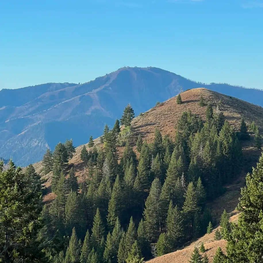
A very popular hike among locals, Taylor Canyon Loop has a lot to offer. For those seeking beauty, it is certainly on tap as the hike begins in a small, attractive canyon before rising to vista points of Bald Mountain, the Boulder and Smoky Mountain ranges and, towards the end, grand views towards the Pioneer Mountains and the Wood River Valley. Those looking for a cardio challenge will not be disappointed, as the middle section of the hike features lung-busting climbs through the woods. Wildlife is often in abundance on the hike and it is common to sight deer and elk as well as dusky sage grouse and other birds along the route.
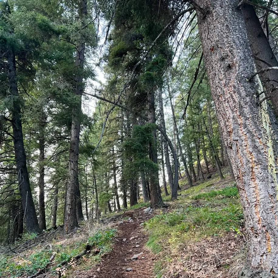
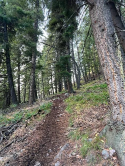
We suggest doing the loop counterclockwise, as the climb in this direction is under the shade of a pine forest. For anyone with less than sure footing, hiking poles are recommended for either route.

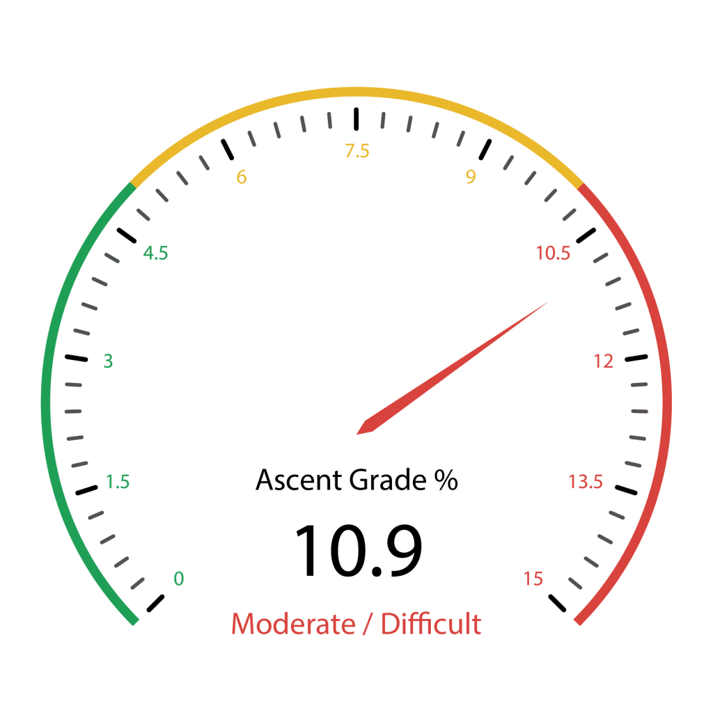
1235 total elevation gain
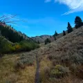
There is very little water on the route – just a stream that parallels the first mile of the hike. During dry periods this stream becomes a mud hole. Given the intense climb and because much of the descent is in the sun, it is recommended to bring plenty of water.
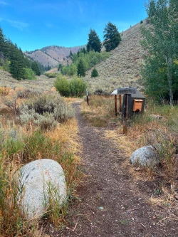
There are no bathrooms at the trailhead.

At .8 miles, the trail veers left and immediately begins to rise a bit more. It is a small taste of what is to come.

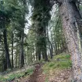
At 1.15 miles, the trail turns left and steepens dramatically as it passes through a small gully. Over the next .4 miles, you will climb about 400 feet, mostly in the shade of the woods.
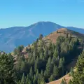
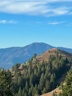
At 1.55 miles, come to a junction with a trail shooting off in front of you. Ignore that and take a right U-turn to continue up the hill. Shortly after the turn you will come to an opening on your left that provides a great view towards the ski slopes on Bald Mountain.

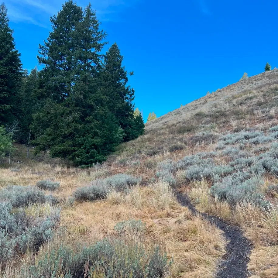
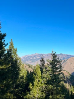
With your back to Bald Mountain, return to the trail and take a left turn to re-start the hike. It will take you to a short descent, but at 1.6 miles you will enter an open hillside and begin to climb again. Much of the next 2 miles are in direct sun. At 1.85 miles, a trail will shoot off behind you to the right, but continue straight. Within a few steps the trail finally flattens and starts to roll along a ridge. As you continue along the ridge, views to the Boulder Mountains will start to open to your right. Even better views will come shortly.
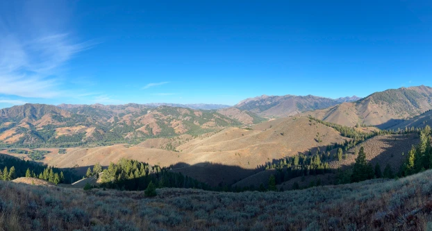
At 2.15 miles, the view opens even wider. This is a great spot to grab a panoramic photo of the Smoky Mountains on the left with the Boulder Mountains rising to the right.
The trail continues to roll along, slowly descending along an open hilltop heading southeast. At 2.4 miles the descent intensifies. As you make your way down the hillside, you will get great views of the Wood River Valley. Continuing, you will see your last climb cut into the hillside straight ahead of you. At 2.75 miles you hit that climb, a 60-foot rise over .15 miles. At the top, the trail rolls pleasantly, but at 3.1 miles, a steep descent begins again, this time over rocky ground. Hiking poles will come in handy for anyone with balky knees or unsure footing.
Below and ahead, you will see the trail rise once again up and over a hilltop. However, you will be turning left immediately before that ascent. Hit that junction at about the 3.6-mile mark and turn left.

This begins another steep descent that continues until the end of the hike. Thankfully, you will finally hit a tree line and find some shade at 3.7 miles. The trail ends back at the parking lot at the 4-mile mark.
Hike Categories
Distance: 0 to 4 miles
Difficulty: Moderate
Drive: Easy
Scenery: Spectacular
Shade: Moderate
Solitude: Busy
Experience: Classics
Locations: Ketchum/SV