Norton Lakes to Norton Pass
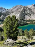
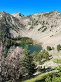
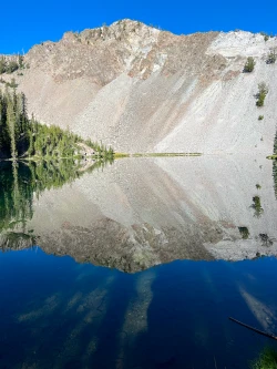
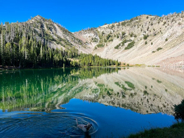
This is a tough hike, but it is incredibly rewarding. The first section is one of the most popular routes in the Wood River Valley and for good reason. A 2.4-mile steady ascent through the woods takes you to two of the most beautiful lakes in the region, Lower and Upper Norton Lakes. The second section is a strenuous 1.1-mile climb to the Norton Pass where you will be rewarded with a bit more solitude along with incredible 360º views of the surrounding mountains. From a rocky knob at about 10,250 feet, enjoy the birds eye view of the turquoise Upper Norton Lake and a far-away peek at Miner Lake.


2660 elevation gain
From downtown Ketchum, it is a 22-mile drive with the last 7 miles on dirt roads. The first 6 of those miles are along the well-maintained Baker Road, but the last mile into the trailhead is a bit bumpy and rocky. Still, any car with healthy tires will be able to make it to the trailhead.
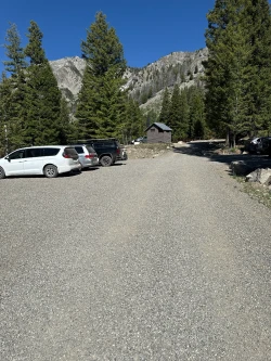
Click here for directions to the trailhead. There is parking for about 20 vehicles, but the lot fills quickly on weekend mornings.
There are bathroom facilities at the trailhead.
The hike to the turnaround can be broken into two sections:
• Section 1: A 2.4-mile steady ascent to Upper Norton Lake
• Section 2: A 1.1-mile strenuous climb to Norton Pass
Section 1:
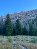
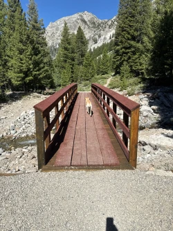
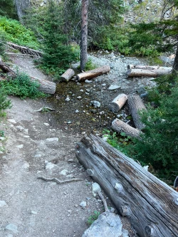
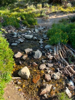
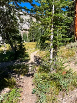
The trail begins at a bridge that spans Norton Creek and quickly turns right at a signed junction. The ascent starts immediately, with an elevation gain of about 175 feet in the first quarter mile. There is an easy stream fording at .6 miles. At .75 miles, come to a junction and stay right.
The climb continues with beautiful views up towards Smoky Mountain peaks. At 1.4 miles you will come alongside a canyon wall of tallus and at 1.9 miles you will again cross the creek.
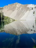
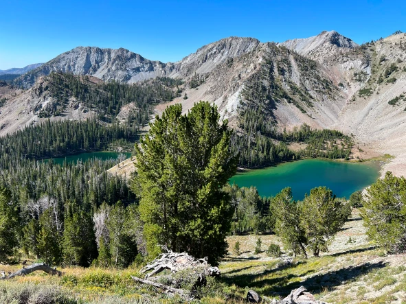
Lower Norton Lake sits 2.1 miles from the trailhead and upon reaching it, you will have gained close to 1300 feet. You will be on the east side of the lake.
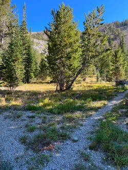
There are paths all around the lake. Some lead to good camping sites and a trail to the north will take you on an excellent hike to Big Lost Lake and Smoky Lake. The route to Upper Norton Lake is fairly easy to find, rising up to the south and through the woods at this junction:
You will once again cross a stream at 2.25 and walk alongside it through a beautiful grassy valley. You will reach Upper Norton Lake at 2.4 miles, gaining another 140 feet from the lower lake.
Section 2:
After visiting the lake and filling your water bottle in preparation for the climb to come, retrace your steps and quickly look to the left for the junction to Norton Pass:
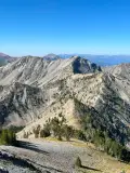
This section of the hike is far less travelled, probably because the climb is quite difficult. Follow the switchbacks and reach a flat area at 3.1 miles. The trail continues to your right with a brutal but short exposed climb to the destination, a knob of rocks that sits at 10,230 feet elevation.
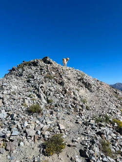
Take some time to rest and enjoy the 360° vistas from the knob. Miner Lake sits far below to the north in a valley framed by the majestic Smoky Mountains.
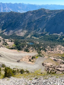
Some hikers continue another half mile to Norton Peak’s apex but the trail can be difficult to follow and finding your footing can be challenging. Most visitors turn and retrace their steps to the trailhead, enjoying breathtaking views of the two Norton Lakes on the way back.
Hike Categories
Distance: 4 to 8
Difficulty: Hard
Drive: Moderate
Scenery: Spectacular
Shade: Shady
Solitude: Moderate
Experience: Classics
Feature: Lakes
Locations: Smokys