North Fork Lake
Getting to the beautiful, secluded North Fork Lake is a real adventure. The drive to the trailhead is a challenge itself, covering nearly 25 miles of dirt roads. Though most of the route is well-maintained, the last mile and a half is better suited for an ATV than a truck (cars are too low-profile to safely make it through that rocky section).
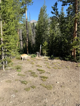
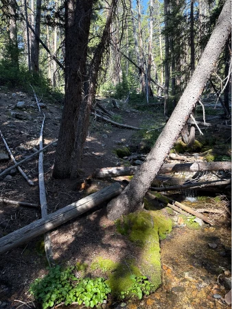
When you finally do make it to the trail, you must keep your head on a swivel as the lightly travelled route is easily lost, particularly whenever you are forced to climb over deadfall. If you are not confident in your sense of direction and route-finding skills, skip this hike as you almost certainly will lose the trail within the first mile and a half.
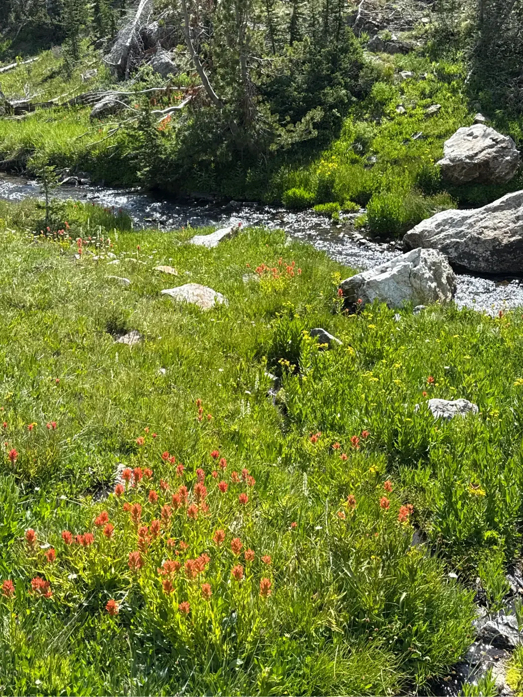
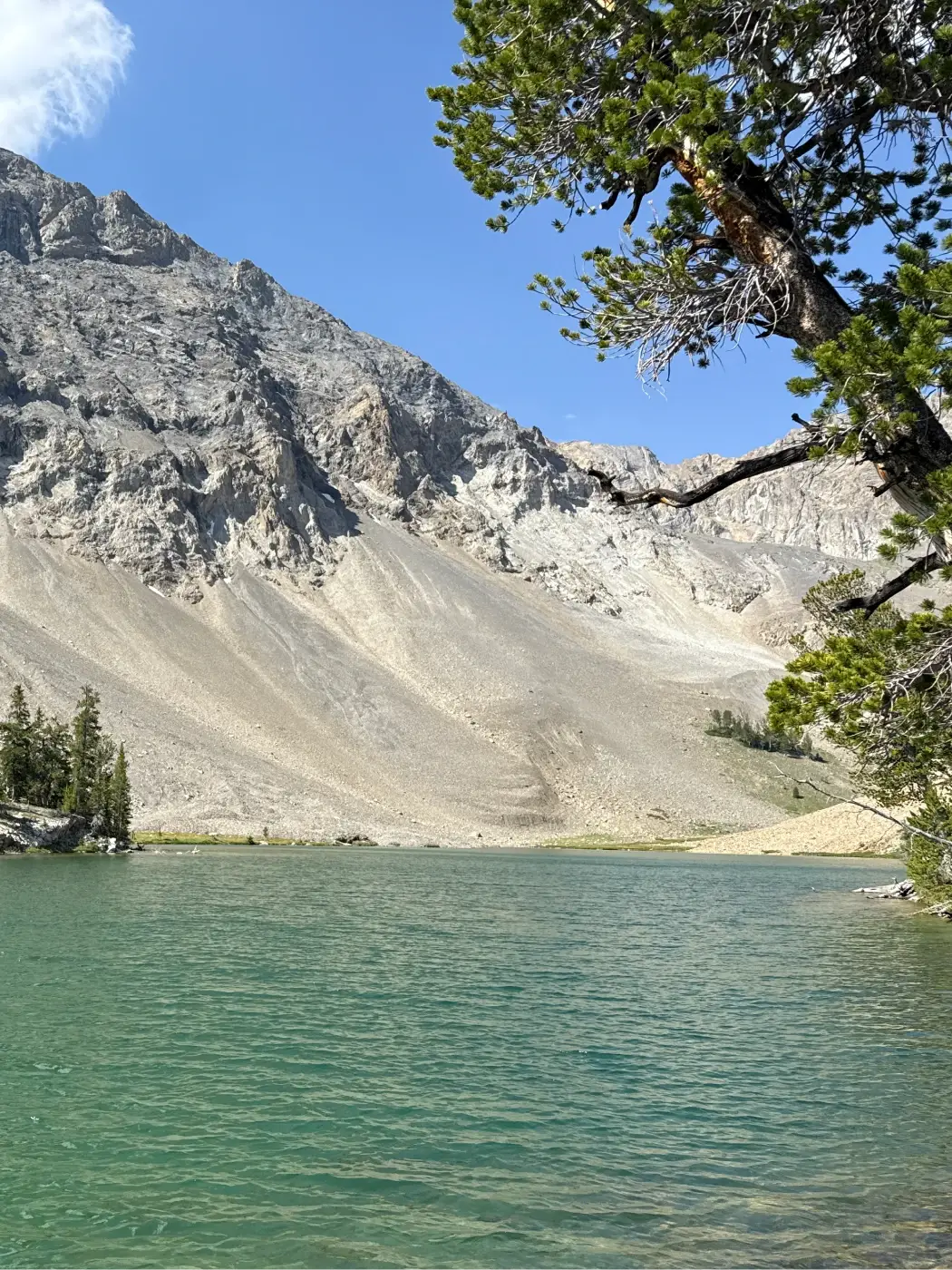
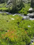
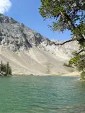
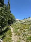
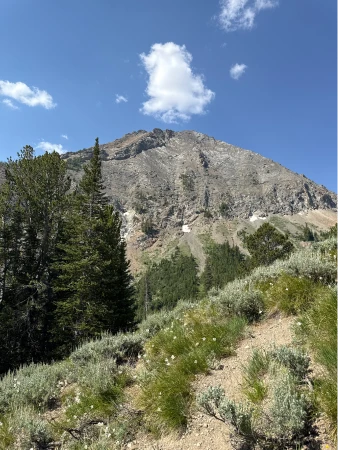
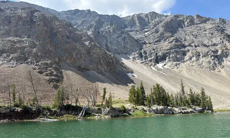
The second half of the hike to the lake is much easier to follow as it ascends through pine forest and mountain meadows awash in mid-summer wildflowers. The climb intensifies over the third mile, but levels out as you approach the turnaround. Your effort pays off as you come over a small rise and get your first look at North Fork Lake, its pale green water lapping up against the raw, wild Boulder Mountains. And best of all, you will very likely have this gem all to yourself.


1415 elevation gain
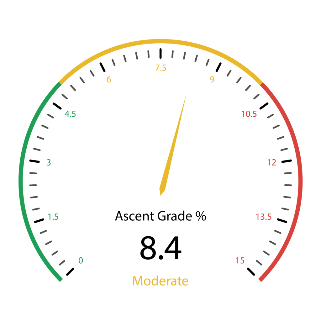 Hardest Mile: 10.5%
Click here for directions to the trailhead. There is parking for about 10 vehicles.
There are no bathroom facilities at the trailhead.

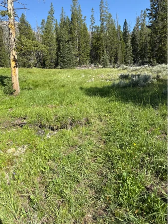
After crossing the river, enter an open sage brush meadow. The trail continues along a barely discernable old road now grown over with grass and summer wildflowers. The trail fades in and out and can be particularly easy to lose whenever you cross over deadfall. If you do lose the trail, continue heading west in a short zig-zag pattern until you rediscover the more defined sections of the route.
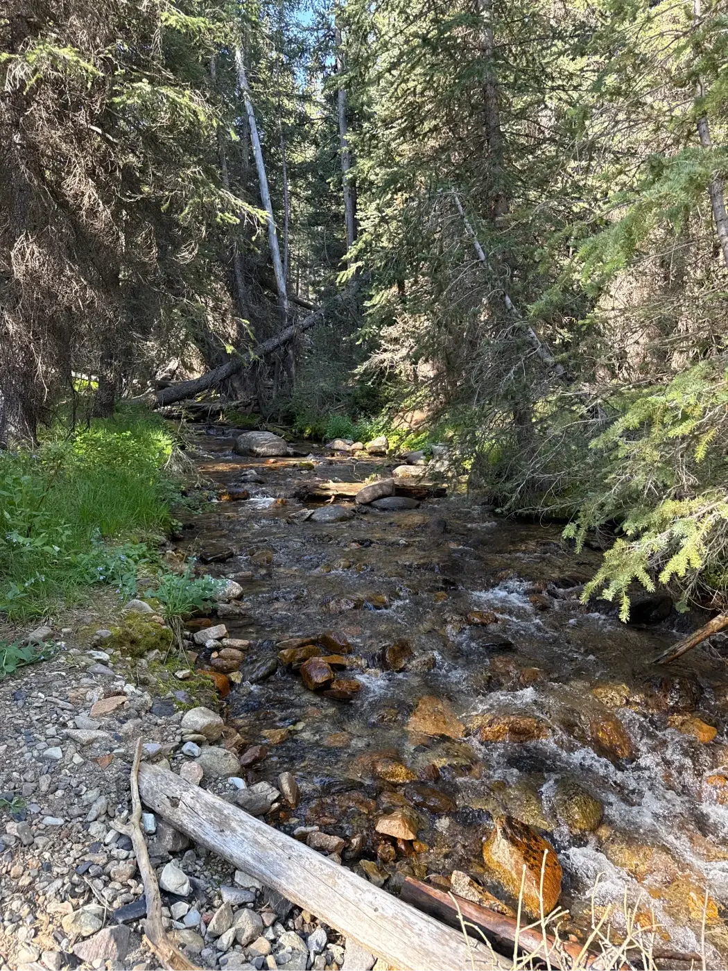
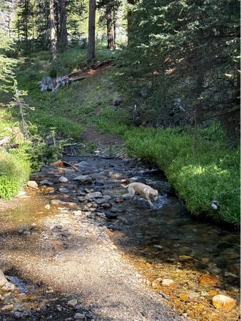
Re-enter the woods at about .4 miles and at .45 miles come to another river crossing.
The trail now moves in and out of small meadows and pine forest. At about .75 miles you will almost certainly lose the trail and your natural tendency will be to head left towards the river. Instead, continue west-by-northwest until you find trampled grass.
Come to an easy water crossing at about 1 mile. The trail on the other side of the ford is easy to follow for a bit before disappearing again at about 1.15 miles. Keep moving west-by-southwest. If you cannot find the trail that way, move left towards the river and walk along the bank until you see the trail clearly running from the opposite bank.
From here on out, the trail is much easier to follow. Move from the woods into a small meadow at about 1.7 miles and then re-enter the woods as the climb intensifies. Shortly after the 2-mile mark, beautiful views open to the Boulder Mountains.
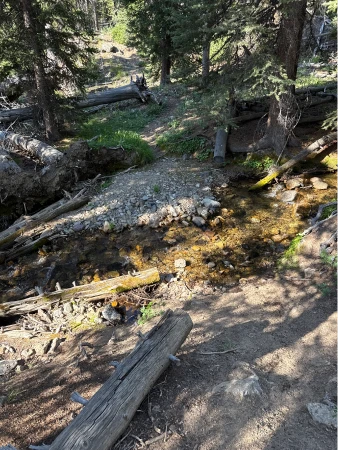
As the climb continues, sounds of a rushing waterfall get clearer with each step. Pass the partially obscured waterfall at about 2.6 miles. The trail then winds through fields of granite boulders and the small river runs alongside the trail. At about 2.9 miles, come to the shoreline of picturesque, remote North Fork Lake. Take plenty of time to enjoy the silence. You earned it.
Hike Categories
Distance: 4 to 8
Difficulty: Moderate
Drive: Hard
Scenery: Nice
Shade: Moderate
Solitude: Quiet
Experience: Beyond the Ordinary
Feature: Lakes
Locations: Boulders