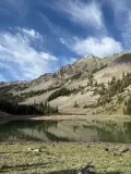
Mill Lake
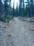
There are multitudes of alpine lakes spread throughout the Sun Valley region. Each lies somewhere on two continuums – from stunningly beautiful to quite stark and from easy to reach to impossible to access. During spring and summer, Mill Lake sits in a sweet spot. It is picturesque and the hike up to it is challenging, but enjoyable. The route starts with a pleasant rolling stroll through a forest before becoming a difficult climb through varied terrains of meadows, forests and tallus hills. The lake itself is serene, framed by the impressive rocky peaks of the Smoky Mountains.
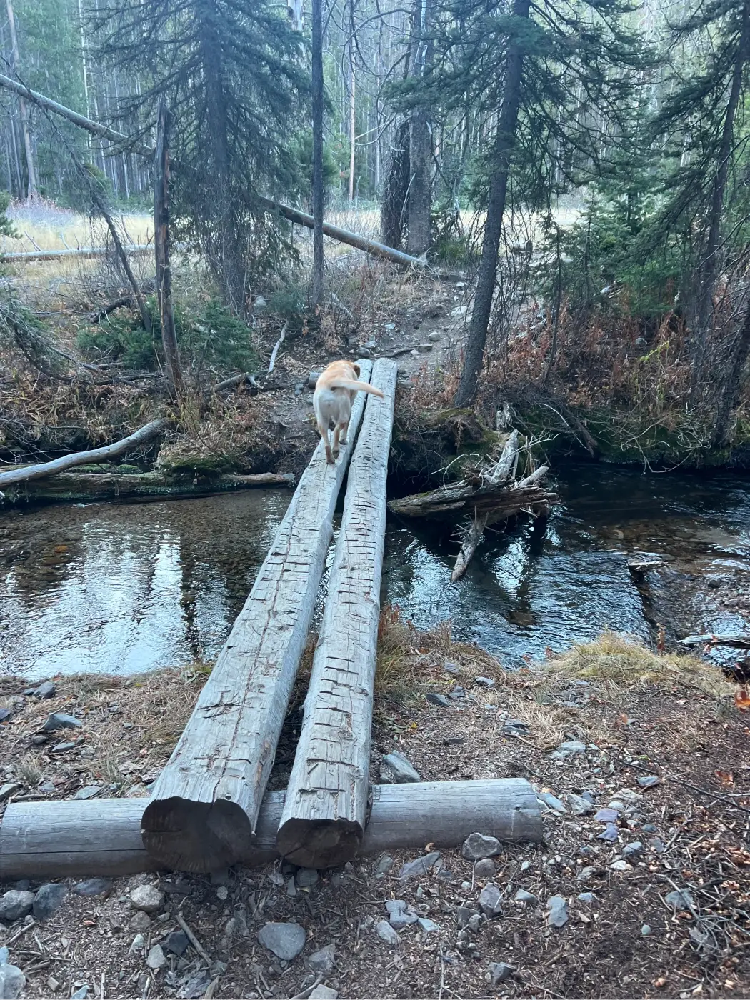
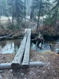
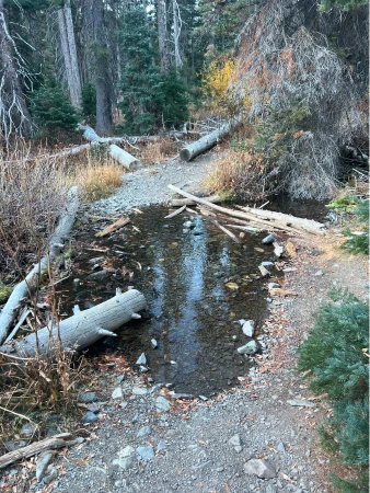
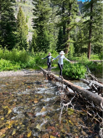
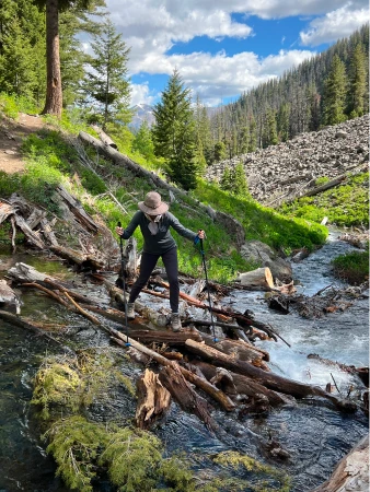
A couple words of warning: first, there are a number of water crossings along the route, with the final one on the ascent being particularly difficult during the spring runoff and other wet periods. It is highly recommended to bring hiking poles to help with the crossings as well as to navigate steep sections of the ascent and descent.
Second, the lake usually runs dry by fall and on dry years starts to shrink by mid-summer, so while the hike itself is always worth the effort, it is best before late summer.


1270 feet total elevation gain
 Toughest Mile: 14.6%
There are bathrooms at the trailhead.
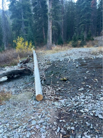
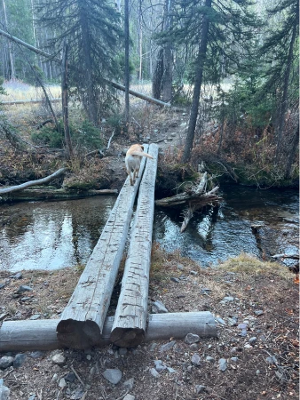
Regardless of which way you start, there are a number of stream crossings within the first 500 feet. Use deadfall to cross each of them.
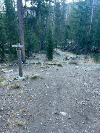
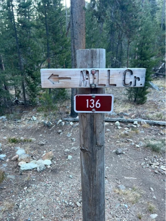
At .15 miles, come to a signed intersection and turn left towards Mill Creek.
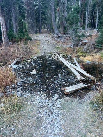
The trail gently undulates through the woods until coming to another water crossing at .35 miles. Use the carved trees to cross and enter a small meadow.
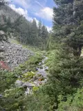
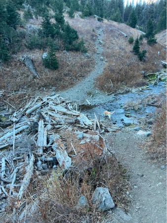
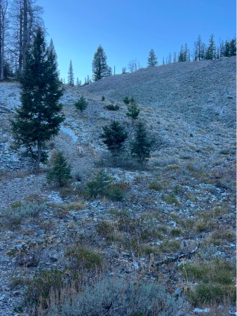
The trail re-enters the forest and continues to roll until .67 miles where the rise intensifies. Mill Creek runs through a nearby gully, sometimes nestling up to the trail with small waterholes offering dogs a chance to cool off and grab a drink. The climb continues until just after the 1-mile mark, when the trail starts to descend to the creek.
The most difficult water crossing is at 1.2 miles. During wet seasons, it is highly recommended to use hiking poles to help you stay dry.
The climb intensifies once again after the crossing – the next .8 mile is the most difficult of the hike, including some particularly hard (but short) spurts. The first of those spurts is as you re-enter the woods at 1.35 miles.
The trail moves out and back into the woods over the next half mile. At 1.8 miles, leave the woods one more time to come face-to-face with the final challenge as the trail jumps straight up over large rock-covered knobs.
The trail finally levels just after the 2-mile mark and winds through sparse woods before easing its way down until it comes to Mill Lake.

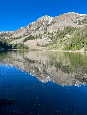
There are trails that lead around the lake and a myriad of dead trees serve as benches to picnic or simply relax.
Hiking poles will come in handy as you re-trace your steps down the rocky knobs. Enjoy expansive straight-ahead views of the Smoky Mountains as you make your way back to the trailhead.
Hike Categories
Distance: 4 to 8
Difficulty: Moderate
Drive: Moderate
Scenery: Nice
Shade: Shady
Solitude: Moderate
Experience: Beyond the Ordinary
Feature: Lakes
Locations: Smokys