Carbonate Mountain
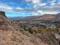
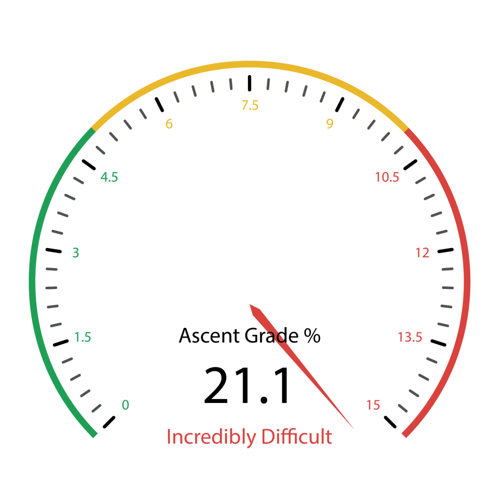
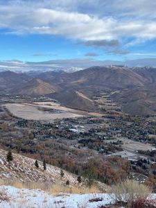
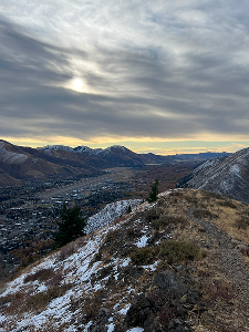
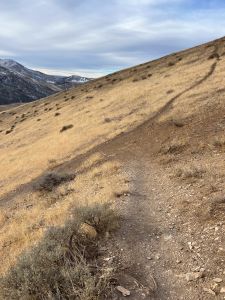
This lung-buster of a hike grabs you by the throat from the first step and does not let go until the incredibly tough, nearly 1400-foot ascent ends just over a mile later. Your reward for taking on the challenge are excellent views of the Wood River Valley from as far north as Ohio Gulch and south down to Bellevue. The hike back down Carbonate Mountain is a pleasant descent down a winding ridgeline trail with more views into Hailey, south past Bellevue and east through Croy Canyon.
Do not climb this route in the heat of day and take time during the ascent to stop and regulate your heart rate. If you find you have bitten off more than you can chew, these directions note the opportunities to bail on the steeper climb and transition the ascent to the easier ridgeline trail. Hiking poles will be helpful no matter which route you choose.
This hike is perfect for those looking for a difficult early/late season challenge and for anyone who wants a birds eye view of Hailey and the Wood River Valley.


1390 total elevation gain
There is no water enroute. Given that the relentless ascent is fully exposed, carry more water than you think you need.
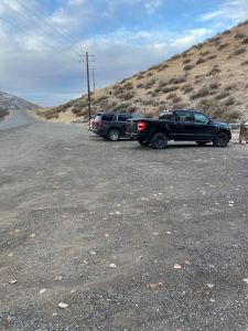
From downtown Ketchum, it is an easy 12.3-mile drive all on paved roads. Click here for directions to the trailhead. There are about 15 parking spots, but they can get scarce by mid-morning during the summer.
There are no bathroom facilities at the trailhead.
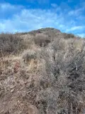
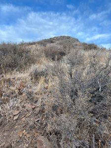
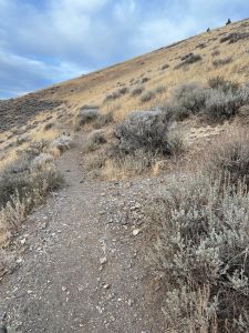
- Section 1: The first 1.25 miles is an incredibly difficult climb that winds through rugged rocks and sagebrush to the hilltop destination.
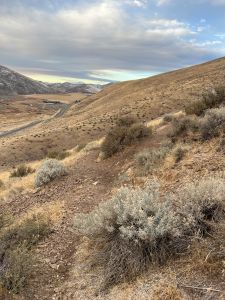
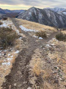
- Section 2: The 2.35 descent begins on a steep finger ridge and then shallows out as it winds down over the open hillside.
Section 1:
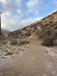
The trail begins with an immediate climb paralleling Croy Creek Road. At about 280 feet, come to an unsigned junction. This is where the loop will eventually end. Turn right and start to scale the rocky ridge. The trail braids as it rises, but throughout the ascent, all offshoots lead to the same place.
Quickly come to the hollowed out remains of an old water tower, now covered in graffiti. This marks the first opportunity to bail on the tough climb and transition to the much easier but significantly longer ascent on the ridgeline trail that winds along the mountain. This easier route will re-connect with the steeper route about .35 miles away from the hilltop destination. To get to the easier trail, skirt along the path for about 50 feet, keeping the graffitied structure on your left.
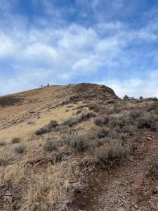
As you look up on the harder ascent, there is a distinctive knob which marks the half mile mark. That is a good mental waypoint for those looking to segment the difficult climb.
Each step improves the view to the City of Hailey and of Croy Creek Canyon. At about the .27-mile mark, come to a jumbled intersection. This is your second opportunity to transition to the easier climb.
As you approach the top of the knob at the half mile mark, the second segment of the climb comes into view.
At .65 miles come to the 3rd opportunity to transition to the easier climb.
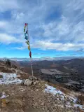
The trail finally does ease just a bit for a few steps just before the .8-mile mark but then rises again. At one mile, come to a pole adorned with several small Tibetan prayer flags. Looking up the hill from the pole presents a view of your final push, still a quarter mile away.
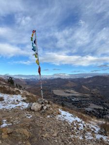
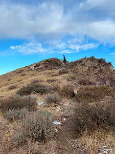
Keep climbing up and over camel-humps and at 1.25 miles, arrive at the hilltop destination. The views from here are magnificent, extending from Ohio Gulch to the north all the way south of the City of Bellevue.
Section 2:
Descend back down the trail and come to an unsigned junction at 1.6 miles. Turn right and begin a short, steep, rocky descent down the finger ridge.
As you continue descending, trails braid around and through the main path. Continue straight until coming to a junction at 1.8 miles. Turn left.
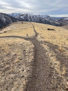
The descent eases as the trail winds along a meadowy ridge. As you approach the 2.25-mile mark, the trail will appear to be taking you too far southwest towards Croy Creek Canyon and you may be tempted to go down a steep chute to your left but continue along and turn left at an unsigned junction at about 2.45 miles.
At the 3-mile mark, you have a choice to take the high road or the low road. The low road is more direct and a bit steeper, but both get you back to the trailhead. This route recommends the high road. After a couple twists and turns, the loop ends as you re-connect with the original trail at about 3.5 miles.
Hike Categories
Distance: 0 to 4 miles
Difficulty: Hard
Drive: Easy
Scenery: Nice
Shade: Sunny
Solitude: Busy
Experience: Classics
Locations: Hailey