Betty-Goat-Baptie Lakes Loop
(aka Jarvis Trail to Broad Canyon Trail)
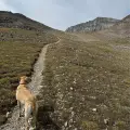
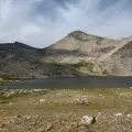
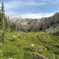
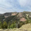
There is nothing easy about this hike. The long drive to the trailhead traverses 30+ miles of dirt roads. The 12-mile trail features lung-busting climbs and the first part of the descent is tough footing over rocky ground. The elevation tops out at over 10,700 feet, challenging even Sun Valley locals accustomed to altitude. But for those who take on this loop, the rewards are awe inspiring. The views are magnificent, the forest scenery is spectacular, the large meadows are stunning (particularly with mid-summer wildflowers), and the three main lakes each offer something different. First up is Betty Lake, a peaceful oasis reached after a difficult climb. After another tough climb comes an outstanding view down to the incredibly stark Goat Lake, which almost wouldn’t seem out of place on the moon. Finally, the trail descends to Baptie Lake, a classic beauty and the perfect spot for backpackers looking to break the hike in two.
This hike requires some planning and equipment. We highly recommend bringing a water filter and a Garmin inReach or any other device that allows you to make satellite calls. You are way out there, so bear spray is a must, if only for peace of mind. But if you’re a fit and experienced hiker, don’t be scared off. The rewards far outweigh the challenge. This is a hike you will always remember.


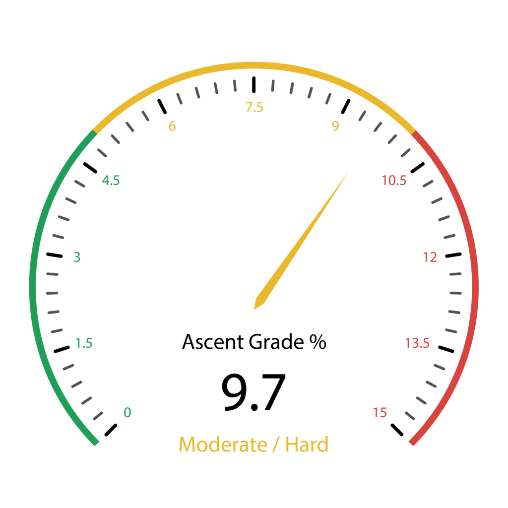
3025 total elevation gain
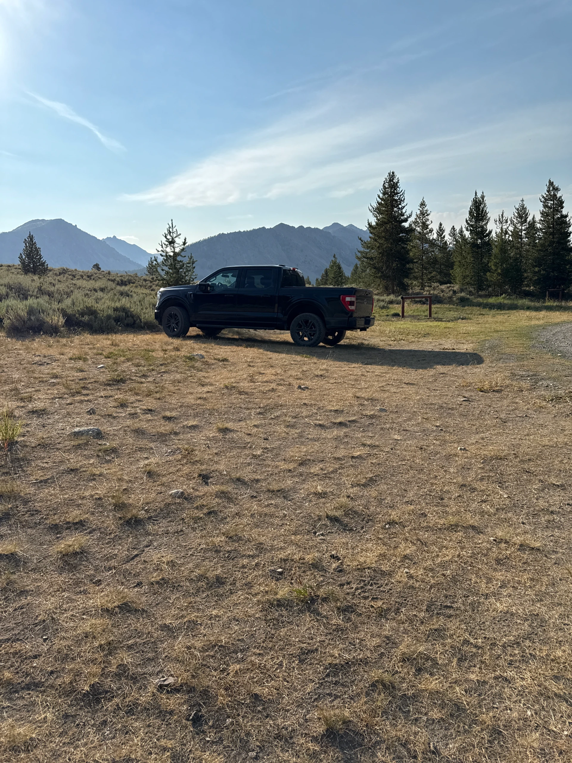
Carefully operated trucks and SUVs should have no issues getting to the trailhead, but we have seen a couple disabled cars on our way to the hike (we did help the drivers!) Check your tires before making the drive and consider bringing a Garmin inReach or another device that allows you to make satellite calls through your cell phone.
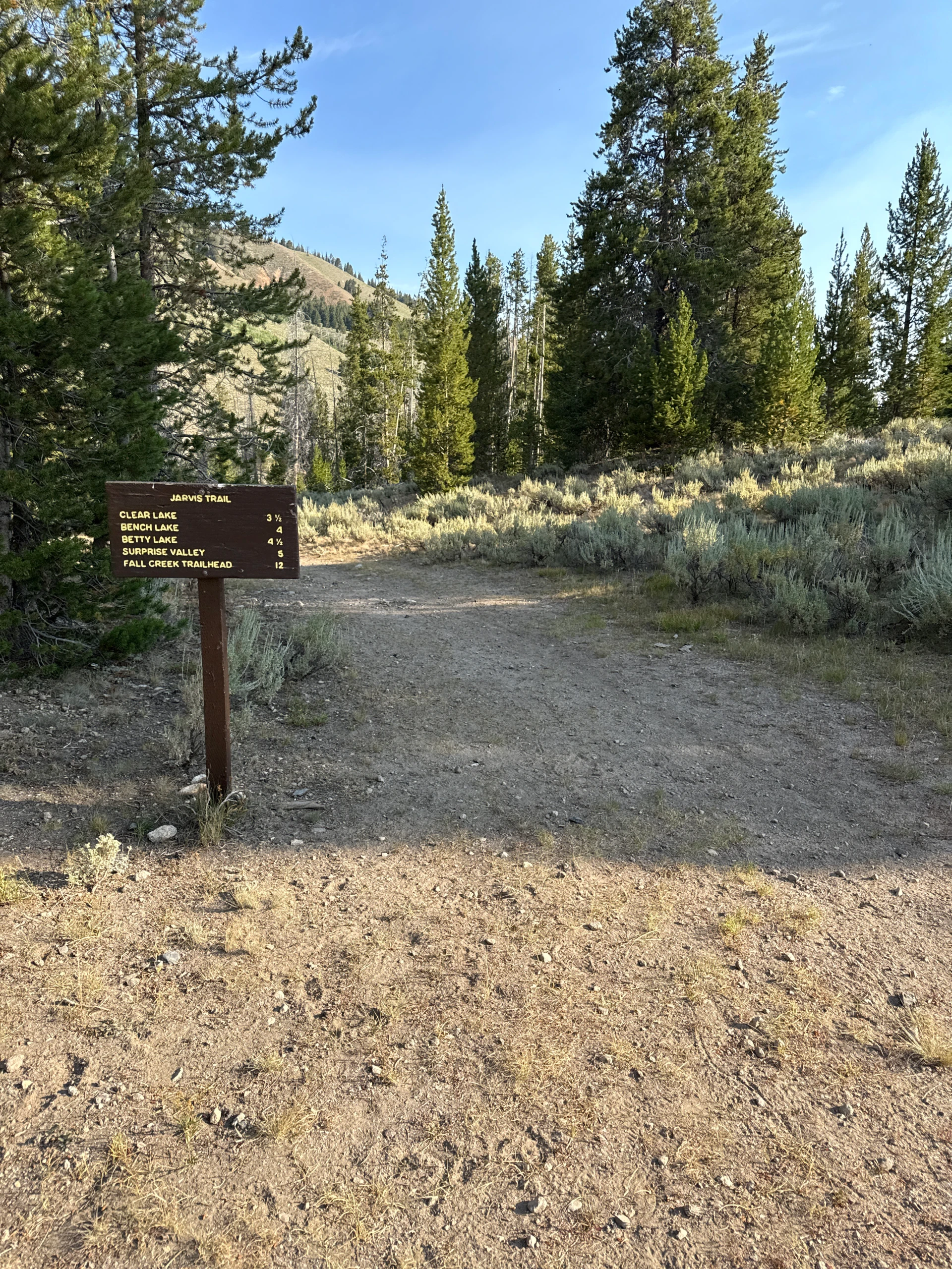
Click here for directions to the trailhead. There is parking for about 8-10 vehicles.
There are bathroom facilities at the trailhead.
Just after the mile mark, the climb intensifies dramatically as the rocky trail passes through light forest. The climb relents at about 1.65 miles and begins a traverse along a sage-covered ridge. Views improve with each step.
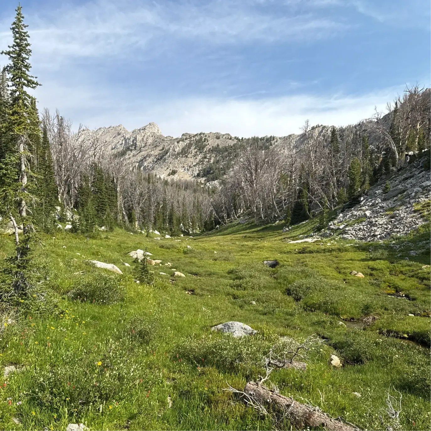
Over the next mile and a half, the creek crosses your path several times, offering a chance to refill water bottles. At about 2.6 miles, the trail rises again and continues to climb as it parallels the burbling creek at 3.2 miles, coming to a small meadow at about 3.3 miles.

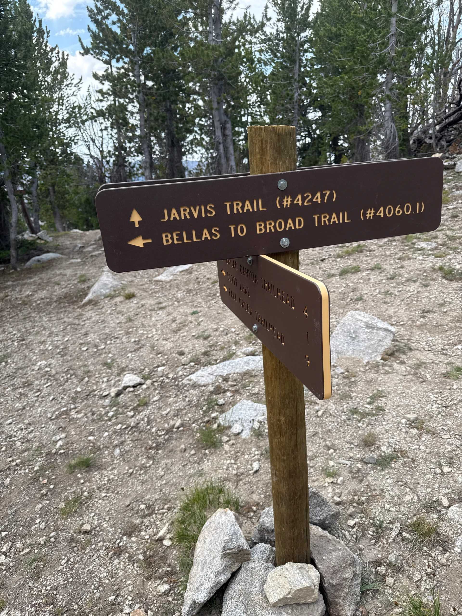
There are a couple easy creek crossings at about 3.4 miles. Shortly after, the climb again rises dramatically. Take your time and catch your breath in this section – the air is thin up here. At 3.8 miles, come to a sign for “Clear Lake.” The sign is wrong (Clear Creek is off trail and a bit higher) but it is a pleasant pond and a great place for dogs to cool off while you rest up for the climb still to come. This is also the signed intersection with the Bellas Lakes hike and the Fall Creek Trailhead.
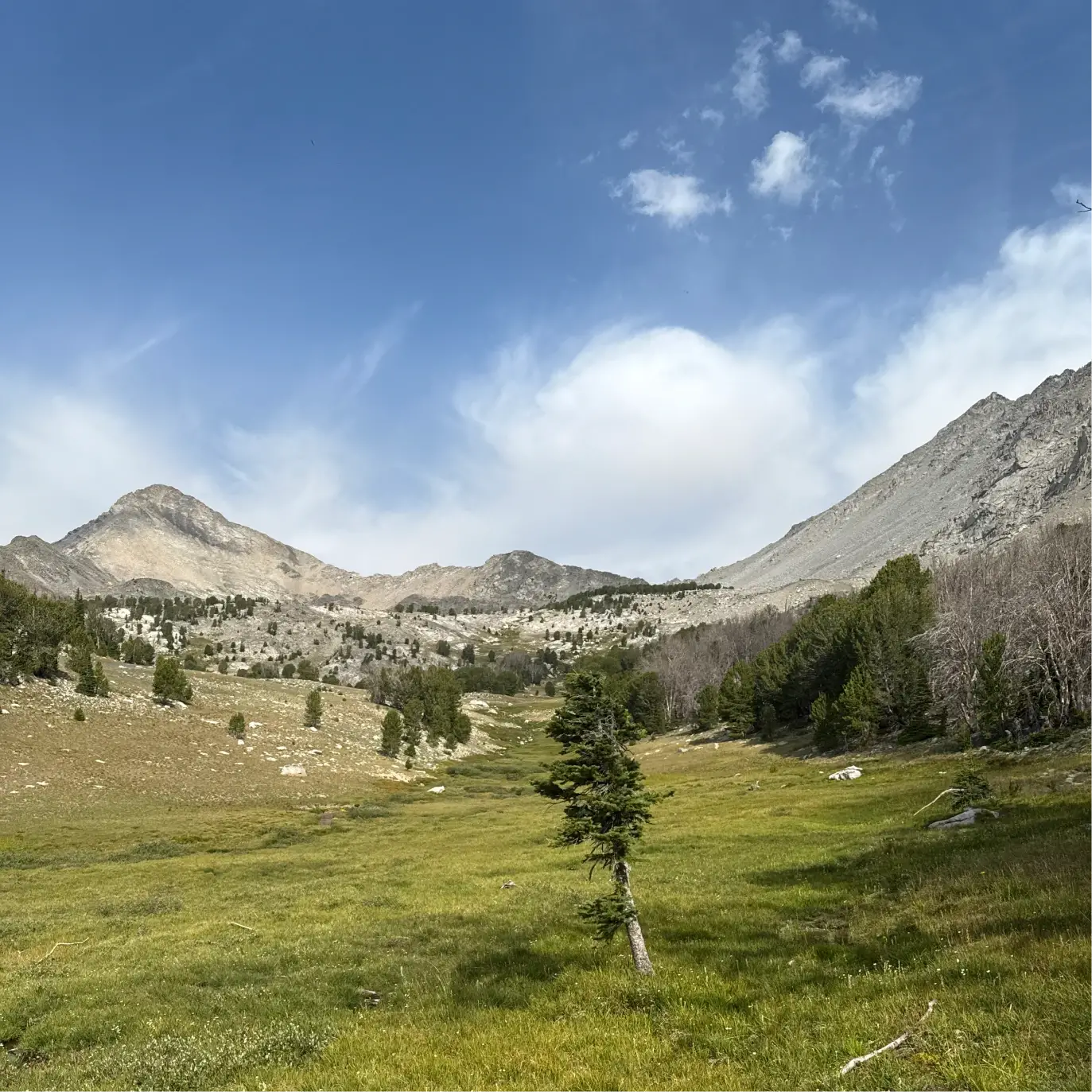
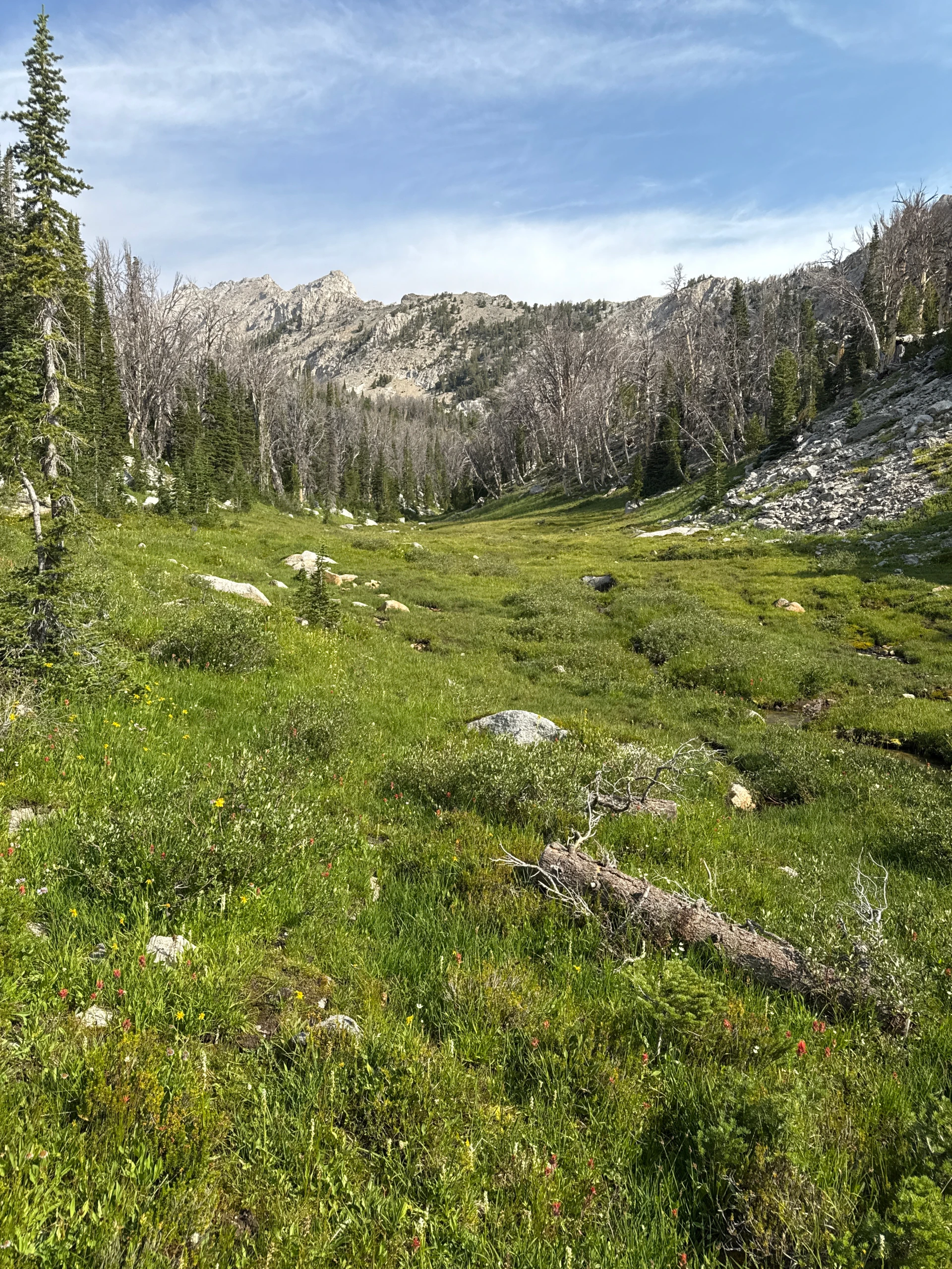
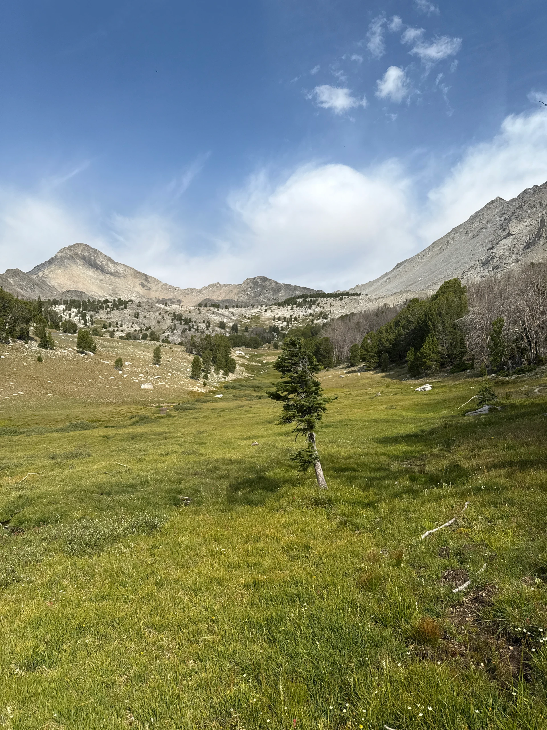
The trail climbs again and then gently descends and enters a large, beautiful meadow at about 4 miles. This is a great spot for campers.
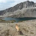
The welcome respite of the meadow ends with another tough climb that starts at 4.4 miles. Over-the-shoulder views back down to the meadow are spectacular. The trail levels for a bit, but there is another burst of climb until you finally reach the sign for Betty Lake at 4.9 miles.
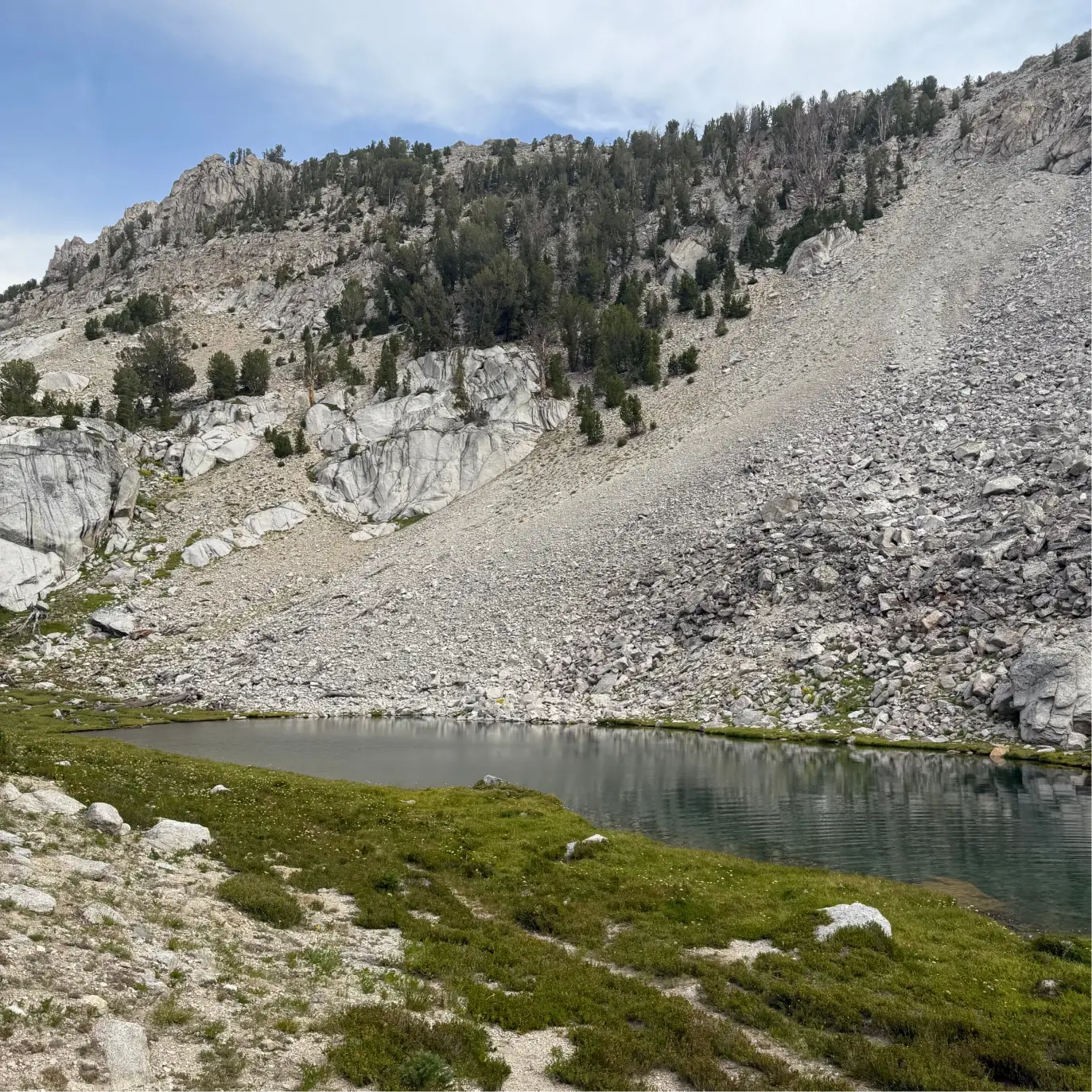
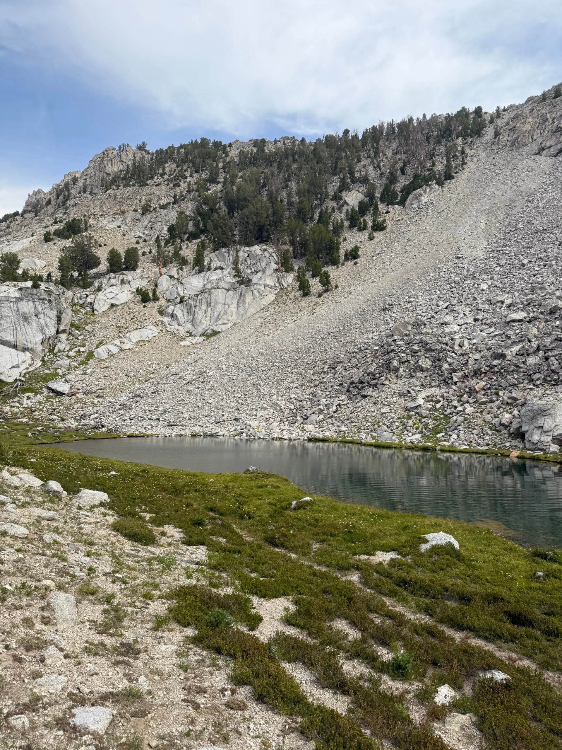
After enjoying the peace of the lake, turn south, keeping the lake to your right to find the trail that leads to Goat Lake. The trail is easy to lose here, but just follow the green vegetation over a small knob and then come to a small, unnamed pond/lake at about 5.2 miles.
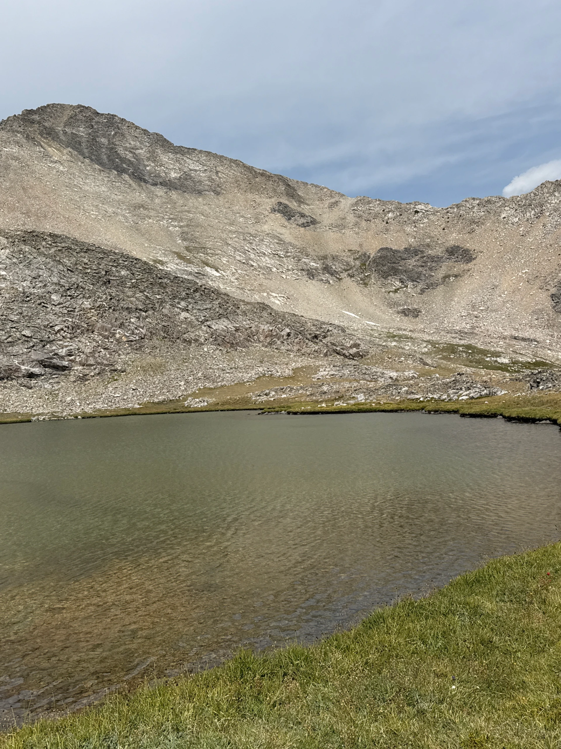
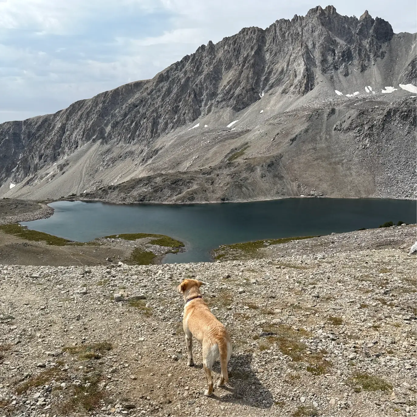
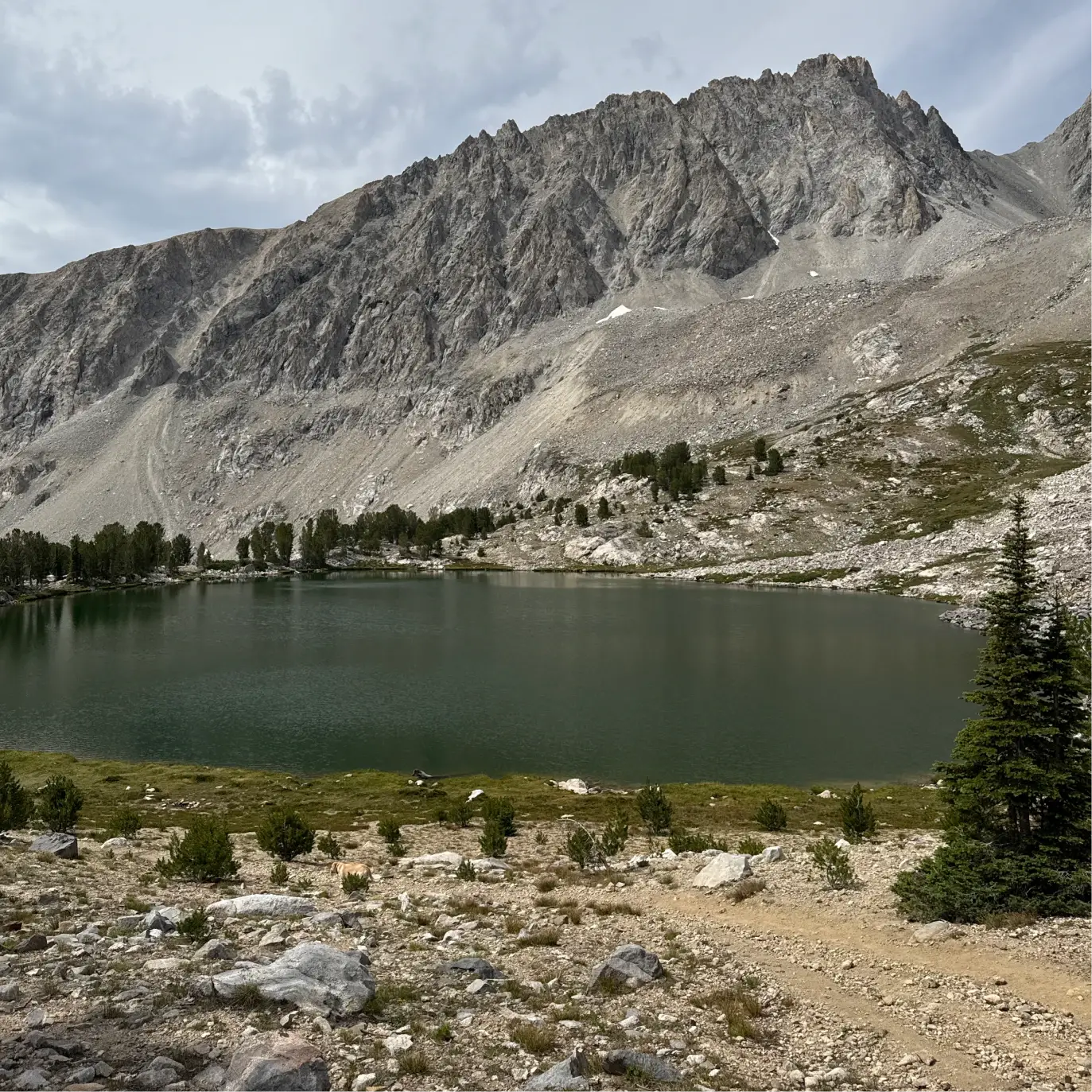
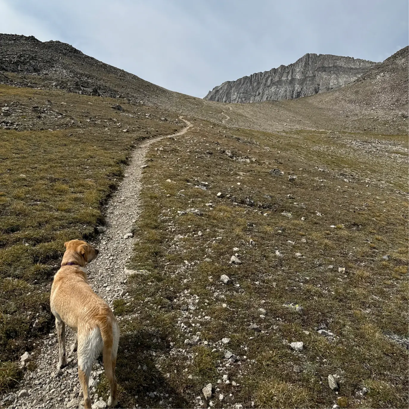
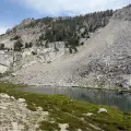
The trail continues to be poorly defined through some of this stretch, but keep the unnamed lake to your left and Betty Lake to your right until you reconnect with the path. It climbs one last time until you mercifully come up and over a 10,765 foot saddle. Goat Lake sits 300 feet below the saddle.
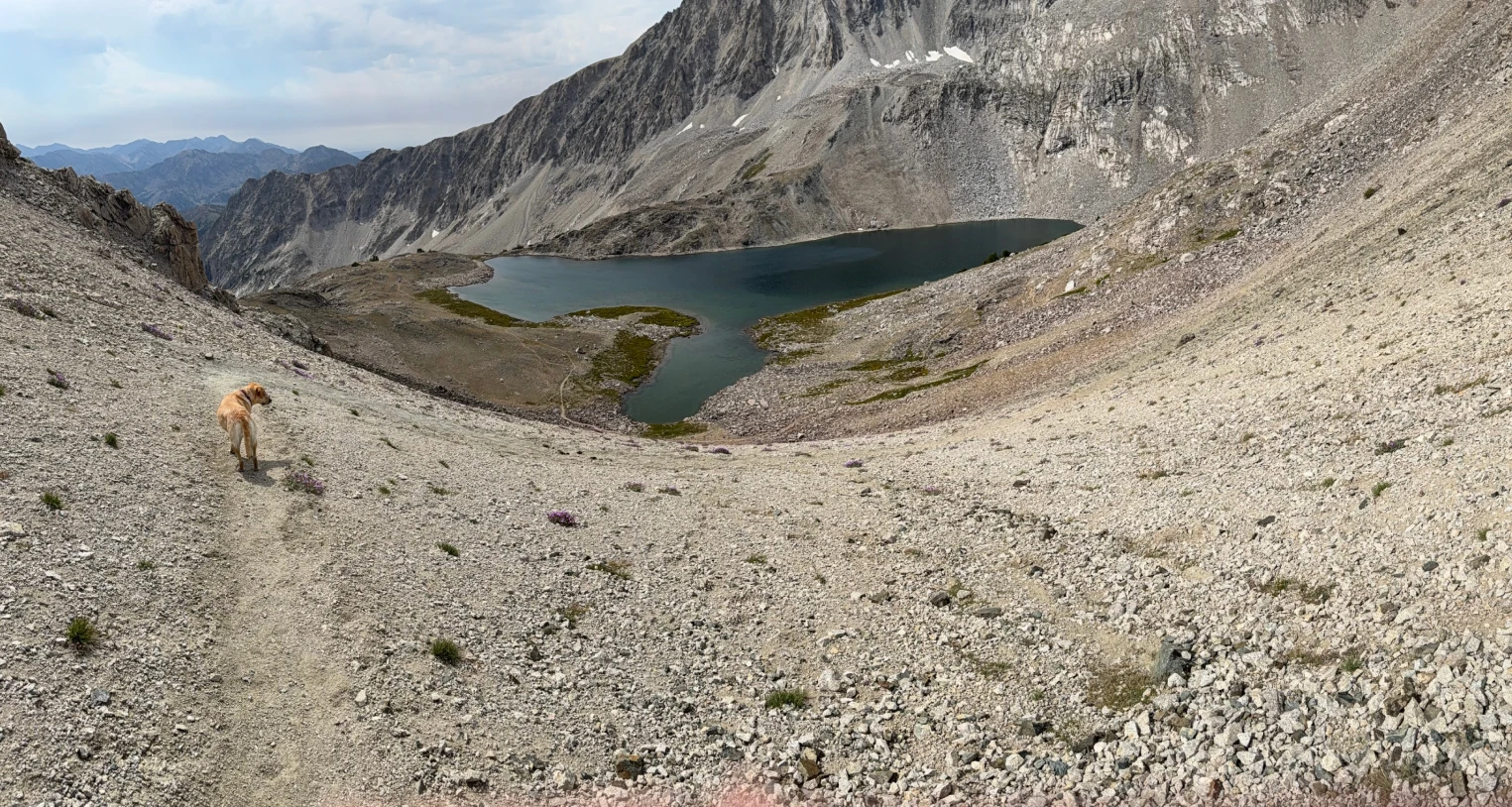
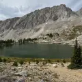
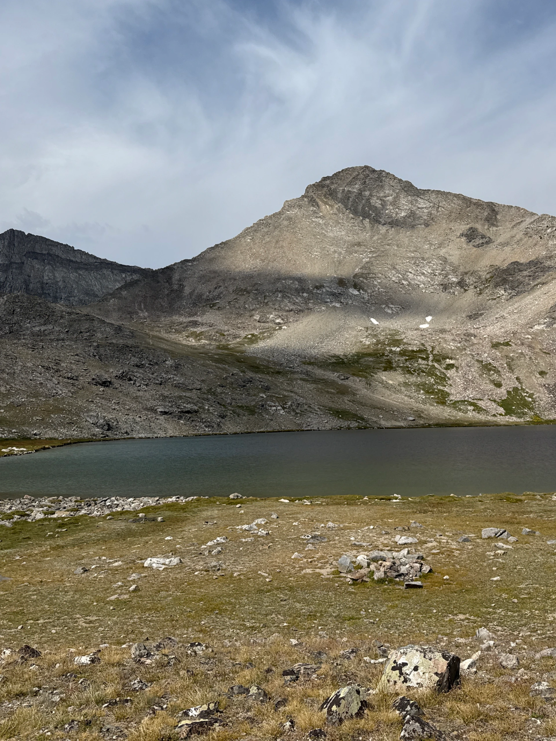
The footing on the way down to Goat Lake is a little treacherous. Pass the lake at around the 6-mile mark and carefully descend through a rocky field. At about 6.4 miles, come to the Baptie Lake. The trees to the left of the lake provide an excellent camping spot for backpackers.
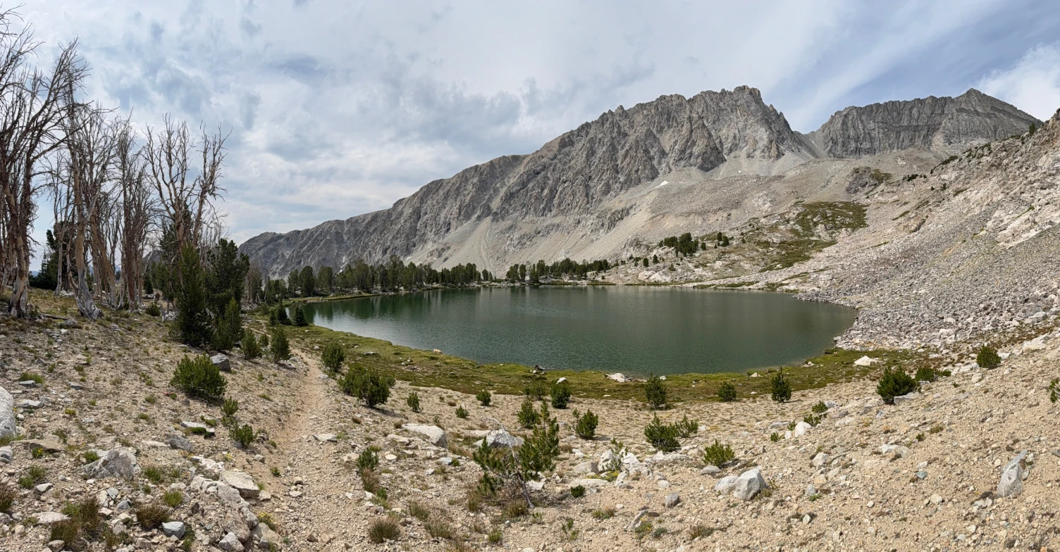
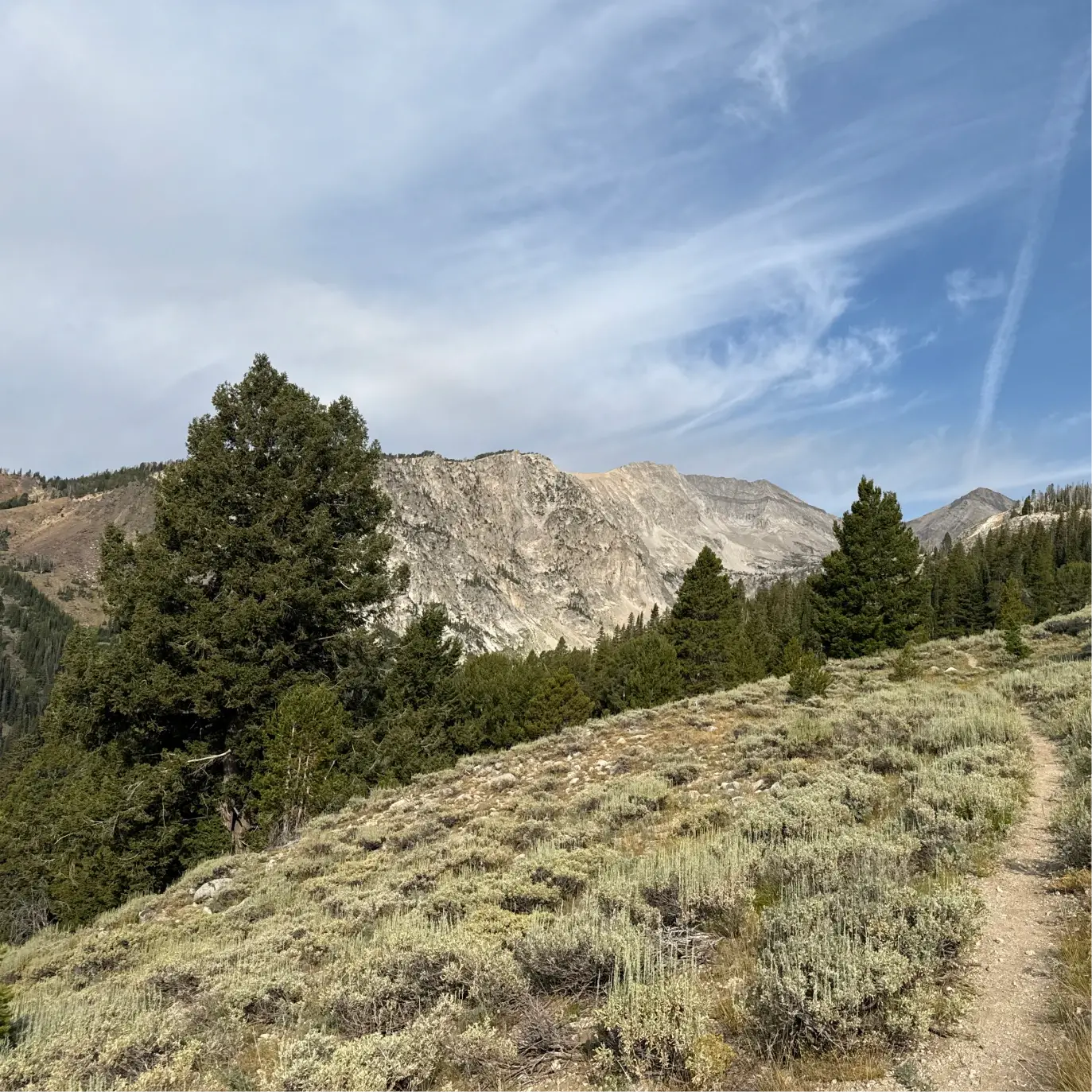
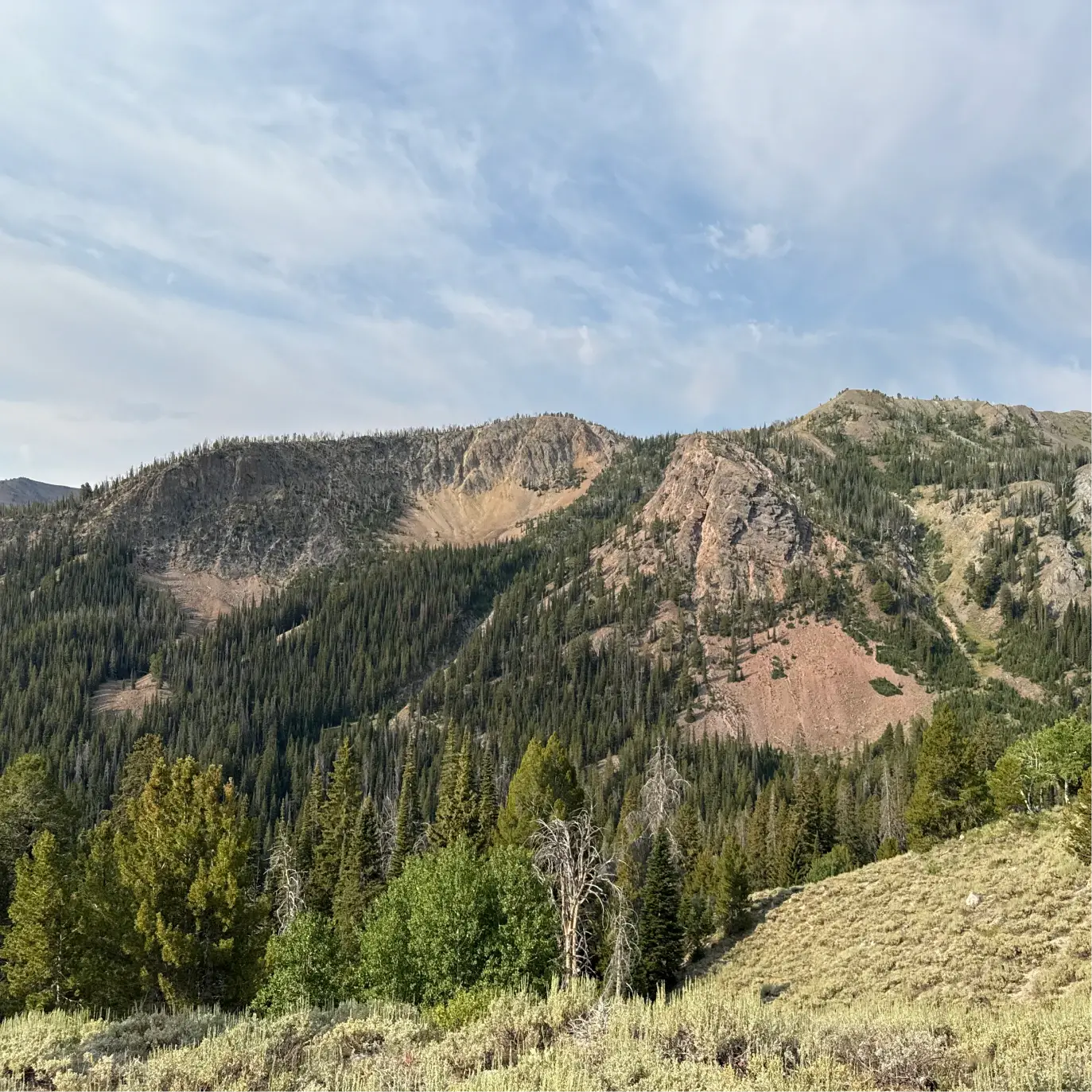
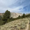
The trail scrambles up from the lake before descending again. In mid-summer there are patches of beautiful wildflowers along the descent. At 6.9 miles the trail levels near a stand of tall trees and the footing gets easier. There is an easy creek crossing at about the 7-mile mark and soon afterwards a sign pointing back to the lakes as well as towards the Surprise Valley and the Fall Creek trailheads. Enter a large meadow after the 7.5-mile mark, pass a pond and cross the creek several times over the few miles. Fantastic views open towards the Pioneer Mountains that rise above.
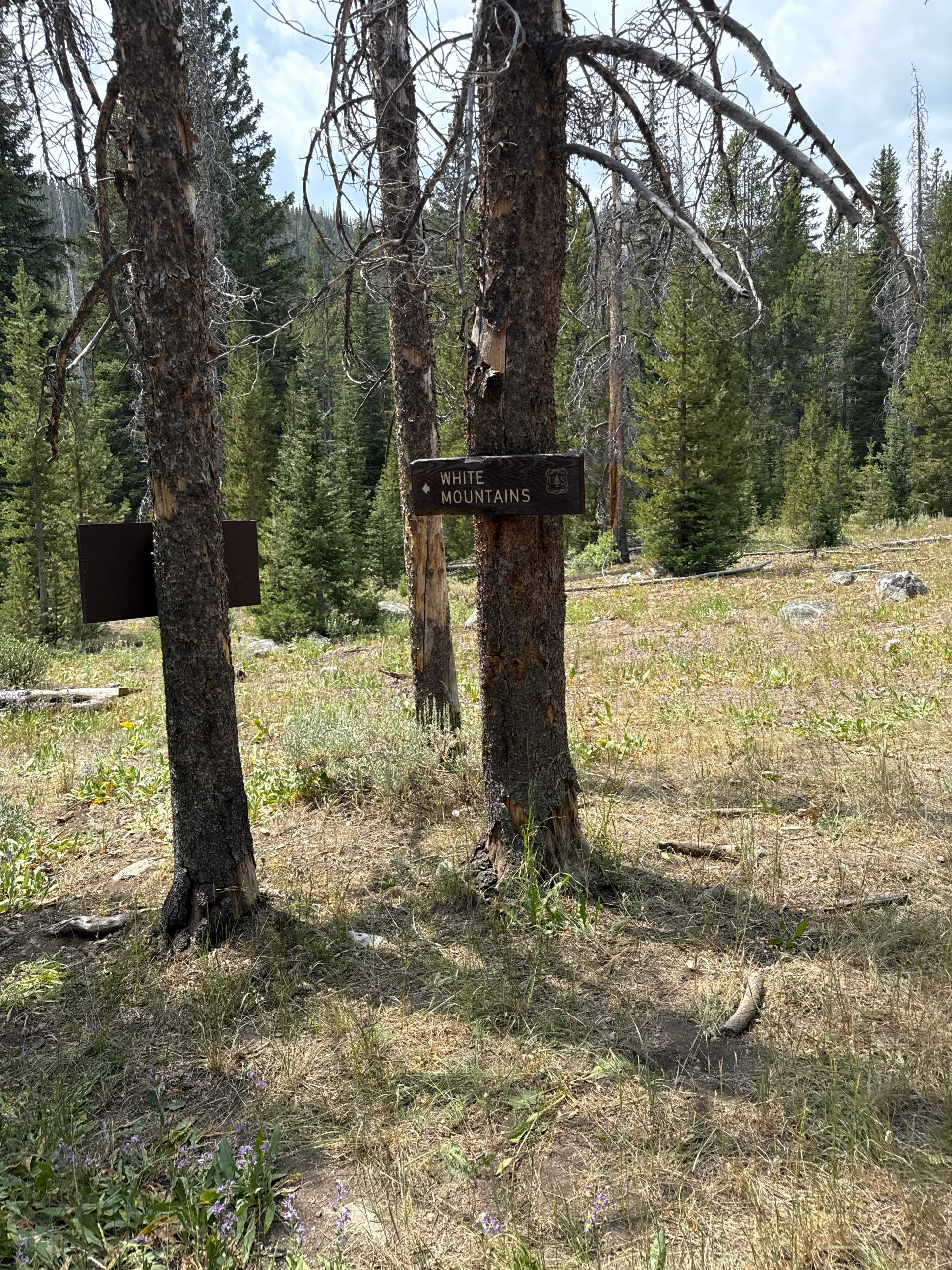
The trail alternates between small patches of woods and meadows as you continue descending. At 10.2 miles, come to a signed junction with a trail towards the White Mountains. Another sign points to your destination, which is a little more than the 1.5 miles indicated.
Continue through the woods and meadows, crossing a bridge at 10.75 miles and then some ponds at 11.2 miles. The trail ends with a couple of rises through the woods. Shortly after a bridge at 11.8 miles, enter the backside of the campground where you parked and stay left to follow the road back to the trailhead.
Hike Categories
Distance: 8+
Difficulty: Hard
Drive: Hard
Scenery: Spectacular
Shade: Moderate
Solitude: Quiet
Experience: Beyond the Ordinary
Feature: Lakes
Locations: Pioneers