Harper’s
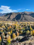
Starting from the Adam’s Gulch trailhead, this hike utilizes a number of trails to make a moderately difficult loop. Along with the cardio challenge, it provides solid views of the Wood River Valley as well as relative peace and quiet once you leave the Sunnyside-Lane’s trail. Though much of the route is in the sun, there are respites of forest along the way.
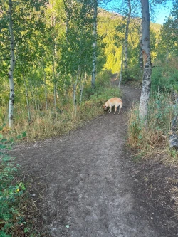
One slight drawback to this hike is that the main ascent is along a popular mountain biking route. Be aware of your surroundings and look for downhill bike traffic, especially if you bring along your dog.
Harper’s is an excellent choice for hikers looking to get the heart pumping without busting a lung and for those who like to get off the beaten path even while staying close to town.


1170 total elevation gain
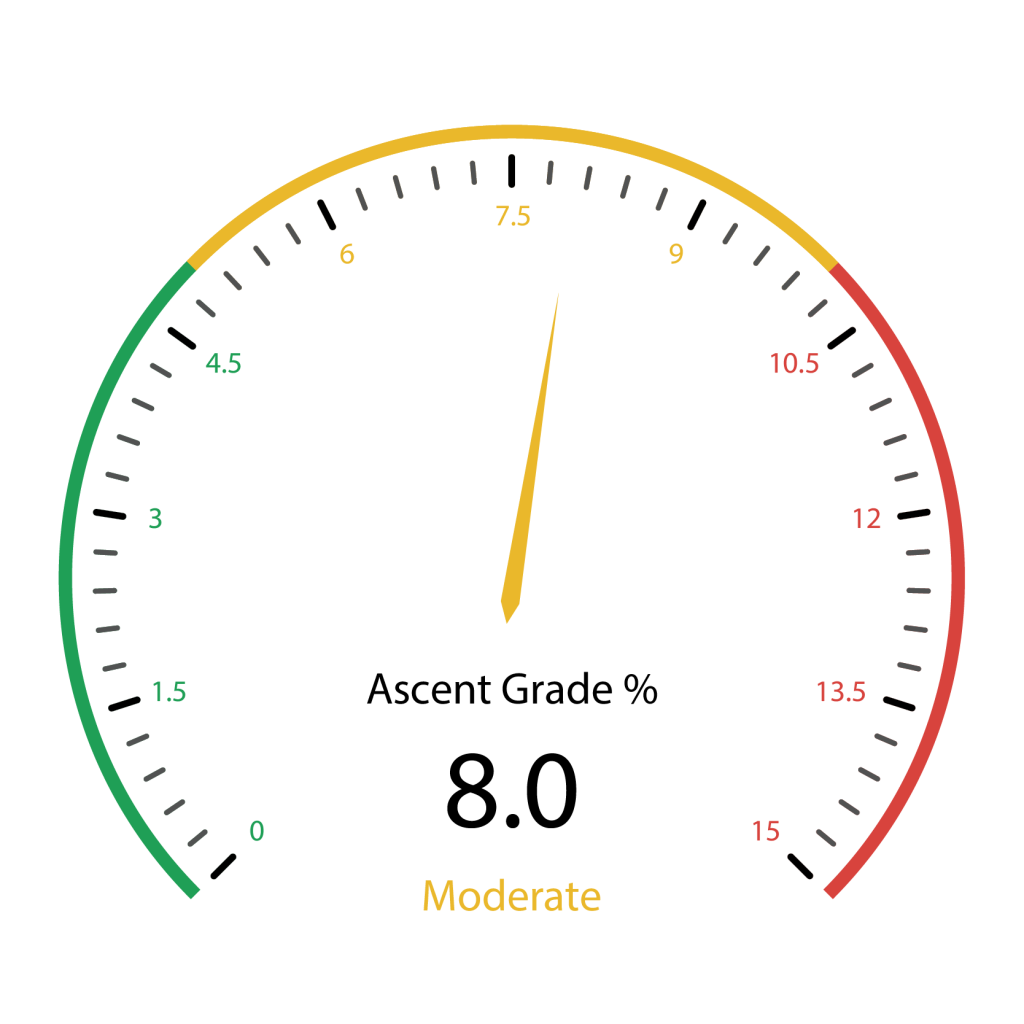 Hardest Mile: 11.6%
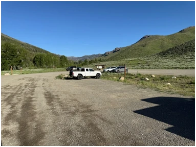
From downtown Ketchum, it is an easy 2.7-mile drive with all but .2 miles being on paved roads. Click here for directions to the trailhead. There is plenty of parking, but spots can get scarce by mid-morning on summer weekends.
There are bathroom facilities at the trailhead.
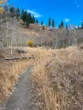
• Section 1: Sunnyside-Lane’s is nearly a mile and is a very gently rising trail through sage brush fields and then groves of aspen and pine trees
• Section 2: The difficult 800-foot main ascent is about 1.3 miles
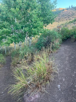
• Section 3: A two-mile descent that alternates between open fields and the cover of forest
• Section 4: A nearly one-mile final push back to trailhead
Section 1: Sunnyside-Lane’s
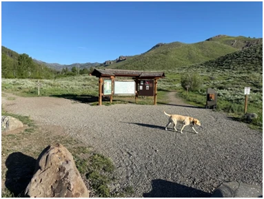
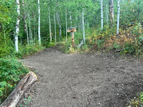
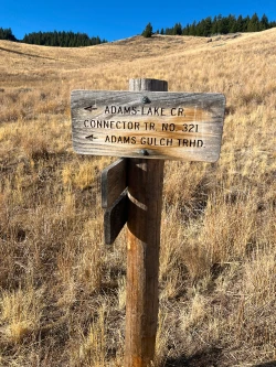
Start by keeping the large Adam’s Gulch trailhead board to your left. Within 400 feet you will pass a sign marking a junction of Sunnyside-Lane’s and Adams-Lake Connector. This is where you will eventually re-emerge to complete the loop. Stay left here and at another junction a few steps later. Continue along through some small patches of pines and aspen groves and come to the first signed junction with Old Adam’s Gulch Road at .55 miles. Stay right to remain on Sunnyside-Lane’s.

The trail continues to wind through similar terrain. Just before .8 miles stay right at another signed junction with Old Adam’s Gulch Road.
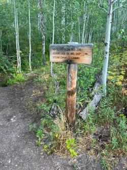
Quickly come to another signed junction with Adam’s Rib Trail just before .9 miles. Turn right.
Section 2: Main ascent
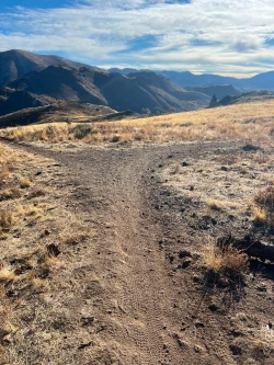
This starts the main ascent, with the trail rising about 800 feet over the next 1.2 miles. It starts on a winding ridge along an open hillside before entering a forest of small aspen trees and a few pines. A small stream runs along to your left and then crosses the trail twice just after the one-mile mark. Except in very wet years, these crossings are easy.
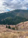
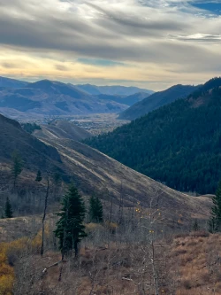
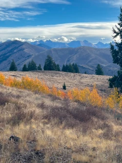
The trail continues to switch back and the trees thin as you ascend. At 1.5 miles, there is a small pond which usually dries up by mid-summer. After the pond, the trail flattens for a few beats and fantastic views into Ketchum emerge. As you continue, the peak of Bald Mountain rises to the south.
Pass an ill-defined trail that shoots to the right after 1.6 miles and cross the stream again at 1.8 miles. The views of the Wood River Valley continue to improve the higher you go.
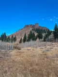
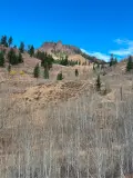
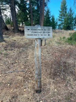
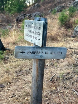
Enter a small stand of pine trees just after the 2-mile mark and at 2.2 miles, the climb peaks out at the signed junction with Harper’s Trail.
Section 3: Two mile descent
Turn right and begin descending through a wheatgrass meadow. There are solid views of the Boulder Mountains to your left with some tall craggy peaks of the mighty Pioneer Mountains rising above.
At the 2.75 mark, pass a grove of small aspen trees on your right and shortly afterwards cross into a pine forest. The trail winds downward through the trees and at 3 miles pass over an earthen bridge crossing a creek. This is the last source of water on the hike.
The trail enters another meadow at 3.25 miles before dipping quickly in and out of another forest grove. Just after the 3.5-mile mark, come to a fork in the trail and stay right.
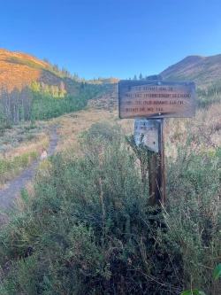
At 3.65 miles, come to a signed junction. Stay right and continue straight, following the sign to the Adam’s Lake Connector/Adam’s Gulch trailhead.
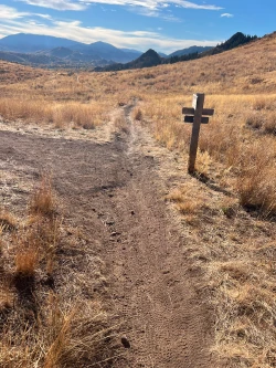
A few steps later, begin a ¼ mile steep descent towards the valley floor. As the trail flattens, come to another unsigned fork in the trail at 4.15 miles. Stay right. Quickly come to another junction and again stay right.

Section 4: The final push to the trailhead
At 4.2 miles, the trail begins to climb again and at 4.4 miles, come to a junction. Turn left and walk 150 feet to a vista point overlooking Ketchum’s Hulen Meadows neighborhood. Re-trace your steps to the main trail which flattens at 4.6 miles and traverses a ridge along a rocky knob. Cross through an old fence line at about 4.75 miles and begin a fairly aggressive descent through a small valley. Just after the 5-mile mark, you will re-emerge at a signed junction that shortly leads to your original trail right near the trailhead. Stay left to finish the hike.

Hike Categories
Distance: 4 to 8
Difficulty: Moderate
Drive: Easy
Scenery: Nice
Shade: Moderate
Solitude: Moderate
Experience: Neither
Feature: Fall Foliage
Locations: Ketchum/SV