Smoky-Big Lost-Norton Lake Loop
If we had to pick just one hike to do each season, this jewel of a journey would be in the mix. It has a little of everything: a tough climb over enough mileage to get the heart pumping, stunning mountain views, and during summer months, beautiful wildflowers. But what makes this hike stand out are its three stunningly beautiful lakes.
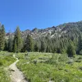
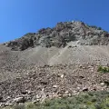
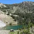
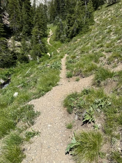
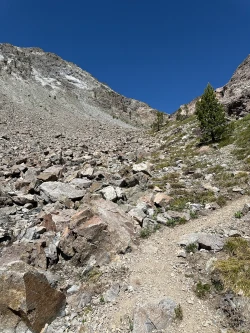
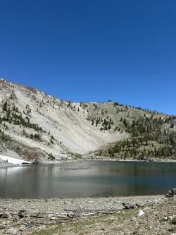
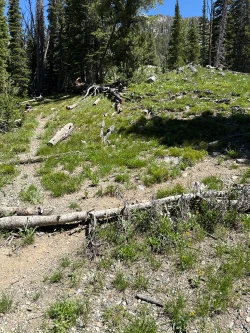
The hike starts off with a bang – a steady ascent under the cover of forest. The climb intensifies as it enters an open hillside, but just as your energy starts to wilt, you catch a glimpse of Smoky Lake, one of the most beautiful alpine lakes our region has on offer. Then, after a tough scramble up a steep rock face, the quiet Big Lost Lake comes into view. Next comes a short climb through the woods and then a difficult ascent down to Lower Norton Lake – poles are highly recommended for this section. It requires some route-finding skills to navigate the edge of Lower Norton Lake and reconnect with the path that leads back to the trailhead.
This is a bit of an adventure. The trail to Smoky and Big Lost are not official Forest Service routes and thus are unmarked, but they are traveled enough to be easily followed over most of the hike. As mentioned, the ascent from Smoky Lake and the descent to Lower Norton Lake require strength and balance and the trail is easily lost as you skirt Lower Norton Lake.
Still, those who take on the challenge will earn their reward.


1690 elevation gain

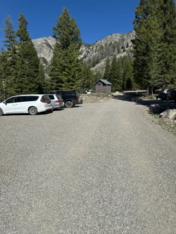
Click here for directions to the trailhead. There is parking for about 20 vehicles, but the lot fills quickly on weekend mornings.
There are bathroom facilities at the trailhead.
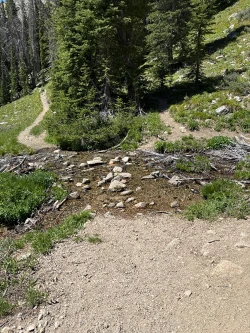
The trail winds along a hillside with a trail above and to your right – you will be returning along that path. The climb intensifies with a short burst uphill right before the mile mark and then the path rises again as you pass through open sage brush fields. Just after the 1.2-mile mark, cross a small stream and begin climbing again. Cross another stream at 1.65 miles and come to a junction at about 1.75 miles. Both routes lead to Smoky Lake.
The path to the right is new and we have yet to take it, though we are told it is an easier way to the lake. We will describe the path to the left, so be aware that if you take the right fork, your distances will slightly vary from ours.
The trail to the left follows a stream that cuts through a narrow gully. You will have to scramble up some boulders and as you crest the gully at 1.9 miles, Smoky Lake appears before you.
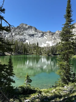
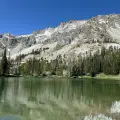
Take some time to enjoy the lake, which is usually quiet. The break will serve you well for the next portion of the hike – a short but very steep scramble up a boulder field. Take time for over-the-shoulder looks towards Smoky Lake, which changes from grey to green and finally to turquoise as you ascend.
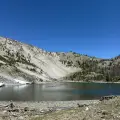
After you crest the boulder field, descend gently down to Big Lost Lake. Big Lost can evaporate nearly to nothing in dry years and it is not nearly as pretty as Smoky, but there is beauty in its starkness.
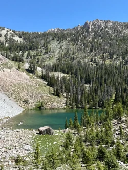
Continue along the path with Big Lost to your left. At 2.45 miles there is a junction and either route takes you to Lower Norton Lake. We stay left. As you head towards your next climb, you may pass a small pond on your right, though it runs dry in hot summers.
After a short climb to a saddle, begin the very difficult descent down to Lower Norton Lake. Even if you usually do not use hiking poles, you will want them for this short section. The trail is easily lost, so take your time and keep your eyes on the path.
At 3 miles, come to a junction with one trail leading down to the lake and the other shooting off to the right. Take the leftward trail to go to the lake on a 1/10th mile spur.
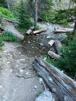
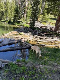
After spending some time on the lake shore, take the short spur back up the hill and take a left at the junction. Head into the woods that surround the lake. You will almost certainly lose the trail here, but keep working your way along the south edge of the lake until you come to its outlet which is covered in deadfall at about 3.35 miles. Cross the deadfall and look for a junction. Turn right.
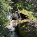
Start descending down a winding path and come to an easy stream crossing at about 3.6 miles.
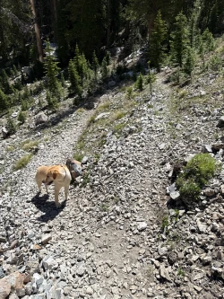
Continue descending back towards the trailhead, passing tallus-covered hills at the 4-mile mark. The trail switches back at around 4.6 miles and at about 5 miles, return to the junction you took .75 miles into the hike. Stay straight and make your way to the trailhead.
Hike Categories
Distance: 4 to 8
Difficulty: Moderate
Drive: Moderate
Scenery: Spectacular
Shade: Moderate
Solitude: Moderate
Experience: Classics
Feature: Lakes
Locations: Smokys